Assam
| Official Name | Assam |
|---|---|
| Administration of Assam | |
| Status | State |
| Statehood / Establishment Date | 26 January 1950 |
| Zone | North-Eastern |
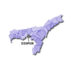
| Capital | Dispur |
| Districts (or Administrative Regions) | 33 |
| Government Website | assam.gov.in |
| Demography of Assam | |
| Largest Cities | Guwahati, Silchar, Dibrugarh and Nagaon |
| Population as per 2011 Census | 31,205,576 [Decadal Growth = 17.1% (from 2001 - 2011)] |
| Population Density | 397 persons / km2 |
| Official Languages | Assamese |
| Other Languages | Bengali and Bodo |
| Sex Ratio as per 2011 Census | 954 ♂ / 1000 ♀ |
| Literacy Rate as per 2011 Census | 72.2% Male = 77.8% and Female = 66.3% |
| Geography of Assam | |
| Total Area | 78,550 km2 |
| Neighbouring States | Assam touches the borders of Arunachal Pradesh, Nagaland, Manipur, Mizoram, Tripura, Meghalaya, West Bengal (total 7 states/UTs). |
| Neighbouring Countries | Border of Assam also touches the international border of Bangladesh, Bhutan (total 2 countries). |
| International Border Length | 530 km |
| Coastal Border Length | Assam is not a coastal state/UT. |
| State Symbols of Assam | |
| State Animal | One-horned rhinoceros (Rhinoceros unicornis) |
| State Bird | White-winged wood duck (Asarcornis scutulata) |
| State Tree | Hollong (Dipterocarpus macrocarpus) |
| State Flower | Kopou phul (Rhynchostylis retusa) |
| Codes for Assam | |
| ISO-3166-2-IN Code | IN-AS |
| Vehicle Code | AS |