Meghalaya
| Official Name | Meghalaya |
|---|---|
| Administration of Meghalaya | |
| Status | State |
| Statehood / Establishment Date | 21 January 1972 |
| Zone | North-Eastern |
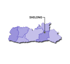
| Capital | Shillong |
| Districts (or Administrative Regions) | 11 |
| Government Website | meghalaya.gov.in |
| Demography of Meghalaya | |
| Largest Cities | Shilong |
| Population as per 2011 Census | 2,966,889 [Decadal Growth = 27.9% (from 2001 - 2011)] |
| Population Density | 132 persons / km2 |
| Official Languages | English |
| Other Languages | Khasi and Garo |
| Sex Ratio as per 2011 Census | 986 ♂ / 1000 ♀ |
| Literacy Rate as per 2011 Census | 74.4% Male = 76% and Female = 72.9% |
| Geography of Meghalaya | |
| Total Area | 22,720 km2 |
| Neighbouring States | Meghalaya touches the borders of Assam (total 1 states/UTs). |
| Neighbouring Countries | Border of Meghalaya also touches the international border of Bangladesh (total 1 countries). |
| International Border Length | 443 km |
| Coastal Border Length | Meghalaya is not a coastal state/UT. |
| State Symbols of Meghalaya | |
| State Animal | Clouded leopard (Neofelis nebulosa) |
| State Bird | Hill myna (Gracula religiosa peninsularis) |
| State Tree | White teak (Gmelina arborea) |
| State Flower | Lady's slipper (Cypripedioideae) |
| Codes for Meghalaya | |
| ISO-3166-2-IN Code | IN-ML |
| Vehicle Code | ML |