Tripura
| Official Name | Tripura |
|---|---|
| Administration of Tripura | |
| Status | State |
| Statehood / Establishment Date | 21 January 1972 |
| Zone | North-Eastern |
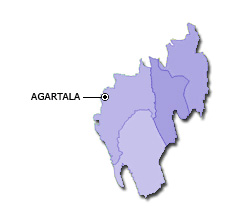
| Capital | Agartala |
| Districts (or Administrative Regions) | 8 |
| Government Website | tripura.gov.in |
| Demography of Tripura | |
| Largest Cities | Agartala |
| Population as per 2011 Census | 3,673,917 [Decadal Growth = 14.8% (from 2001 - 2011)] |
| Population Density | 350 persons / km2 |
| Official Languages | Bengali, English and Kokborok |
| Other Languages | |
| Sex Ratio as per 2011 Census | 961 ♂ / 1000 ♀ |
| Literacy Rate as per 2011 Census | 87.2% Male = 91.5% and Female = 82.7% |
| Geography of Tripura | |
| Total Area | 10,492 km2 |
| Neighbouring States | Tripura touches the borders of Assam, Mizoram (total 2 states/UTs). |
| Neighbouring Countries | Border of Tripura also touches the international border of Bangladesh (total 1 countries). |
| International Border Length | 856 km |
| Coastal Border Length | Tripura is not a coastal state/UT. |
| State Symbols of Tripura | |
| State Animal | Phayre's langur (Trachypithecus phayrei) |
| State Bird | Green imperial pigeon (Ducula aenea) |
| State Tree | Agar (Aquillaria agallocha) |
| State Flower | Nag Kesar (Mesua ferrea) |
| Codes for Tripura | |
| ISO-3166-2-IN Code | IN-TR |
| Vehicle Code | TR |