West Bengal
| Official Name | West Bengal |
|---|---|
| Administration of West Bengal | |
| Status | State |
| Statehood / Establishment Date | 26 January 1950 |
| Zone | Eastern |
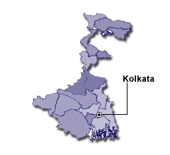
| Capital | Kolkata |
| Districts (or Administrative Regions) | 23 |
| Government Website | wb.gov.in |
| Demography of West Bengal | |
| Largest Cities | Kolkata, Haora, Durgapur, Asansol and Siliguri |
| Population as per 2011 Census | 91,276,115 [Decadal Growth = 13.8% (from 2001 - 2011)] |
| Population Density | 1,029 persons / km2 |
| Official Languages | Bengali |
| Other Languages | Hindi, Odia, Punjabi, Santali, Urdu and Nepali |
| Sex Ratio as per 2011 Census | 947 ♂ / 1000 ♀ |
| Literacy Rate as per 2011 Census | 76.3% Male = 81.7% and Female = 70.5% |
| Geography of West Bengal | |
| Total Area | 88,752 km2 |
| Neighbouring States | West Bengal touches the borders of Odisha, Jharkhand, Bihar, Sikkim, Assam (total 5 states/UTs). |
| Neighbouring Countries | Border of West Bengal also touches the international border of Bangladesh, Bhutan, Nepal (total 3 countries). |
| International Border Length | 2510 km |
| Coastal Border Length | The total length of coast line of West Bengal is 158 km |
| State Symbols of West Bengal | |
| State Animal | Fishing cat (Prionailurus viverrinus) |
| State Bird | White-breasted kingfisher (Halcyon smyrnensis) |
| State Tree | Alstonia (Alstonia scholaris) |
| State Flower | Night-flowering Jasmine (Nyctanthes arbor-tristis) |
| Codes for West Bengal | |
| ISO-3166-2-IN Code | IN-WB |
| Vehicle Code | WB |