Rajasthan
| Official Name | Rajasthan |
|---|---|
| Administration of Rajasthan | |
| Status | State |
| Statehood / Establishment Date | 1 November 1956 |
| Zone | Northern |
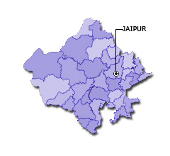
| Capital | Jaipur |
| Districts (or Administrative Regions) | 33 |
| Government Website | rajasthan.gov.in |
| Demography of Rajasthan | |
| Largest Cities | Jaipur, Jodhpur, Kota, Bikaner and Ajmer |
| Population as per 2011 Census | 68,548,437 [Decadal Growth = 21.3% (from 2001 - 2011)] |
| Population Density | 201 persons / km2 |
| Official Languages | Hindi |
| Other Languages | Rajasthani and English |
| Sex Ratio as per 2011 Census | 926 ♂ / 1000 ♀ |
| Literacy Rate as per 2011 Census | 66.1% Male = 79.2% and Female = 52.1% |
| Geography of Rajasthan | |
| Total Area | 342,269 km2 |
| Neighbouring States | Rajasthan touches the borders of Gujarat, Punjab, Haryana, Uttar Pradesh, Madhya Pradesh (total 5 states/UTs). |
| Neighbouring Countries | Border of Rajasthan also touches the international border of Pakistan (total 1 countries). |
| International Border Length | 1170 km |
| Coastal Border Length | Rajasthan is not a coastal state/UT. |
| State Symbols of Rajasthan | |
| State Animal | Dromedary Camel (Camelus dromedarius) |
| State Bird | Great Indian bustard (Ardeotis nigriceps) |
| State Tree | Khejri (Prosopis cineraria) |
| State Flower | Rohira (Tecomella undulata) |
| Codes for Rajasthan | |
| ISO-3166-2-IN Code | IN-RJ |
| Vehicle Code | RJ |