Gujarat
| Official Name | Gujarat |
|---|---|
| Administration of Gujarat | |
| Status | State |
| Statehood / Establishment Date | 1 May 1960 |
| Zone | Western |
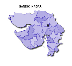
| Capital | Gandhinagar |
| Districts (or Administrative Regions) | 33 |
| Government Website | gujaratindia.gov.in |
| Demography of Gujarat | |
| Largest Cities | Ahmedabad, Surat, Vadodara, Rajkot and Bhavnagar |
| Population as per 2011 Census | 60,439,692 [Decadal Growth = 19.3% (from 2001 - 2011)] |
| Population Density | 308 persons / km2 |
| Official Languages | Gujarati |
| Other Languages | |
| Sex Ratio as per 2011 Census | 918 ♂ / 1000 ♀ |
| Literacy Rate as per 2011 Census | 78% Male = 85.8% and Female = 69.7% |
| Geography of Gujarat | |
| Total Area | 196,024 km2 |
| Neighbouring States | Gujarat touches the borders of Rajasthan, Madhya Pradesh, Maharashtra (total 3 states/UTs). |
| Neighbouring Countries | Border of Gujarat also touches the international border of Pakistan (total 1 countries). |
| International Border Length | 506 km |
| Coastal Border Length | The total length of coast line of Gujarat is 1215 km |
| State Symbols of Gujarat | |
| State Animal | Asiatic lion (Panthera leo persica) |
| State Bird | Greater flamingo (Phoenicopterus roseus) |
| State Tree | Mango (Mangifera indica) |
| State Flower | African Marigold (Tagetes erecta) |
| Codes for Gujarat | |
| ISO-3166-2-IN Code | IN-GJ |
| Vehicle Code | GJ |