Haryana
| Official Name | Haryana |
|---|---|
| Administration of Haryana | |
| Status | State |
| Statehood / Establishment Date | 1 November 1966 |
| Zone | Northern |
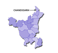
| Capital | Chandigarh |
| Districts (or Administrative Regions) | 22 |
| Government Website | haryana.gov.in |
| Demography of Haryana | |
| Largest Cities | Faridabad, Gurgaon, Rohtak, Hisar and Panipat |
| Population as per 2011 Census | 25,351,462 [Decadal Growth = 19.9% (from 2001 - 2011)] |
| Population Density | 573 persons / km2 |
| Official Languages | Hindi |
| Other Languages | Punjabi and Haryanavi |
| Sex Ratio as per 2011 Census | 877 ♂ / 1000 ♀ |
| Literacy Rate as per 2011 Census | 75.6% Male = 84.1% and Female = 65.9% |
| Geography of Haryana | |
| Total Area | 44,212 km2 |
| Neighbouring States | Haryana touches the borders of Rajasthan, Punjab, Himachal Pradesh, Uttarakhand, Uttar Pradesh, Delhi (total 6 states/UTs). |
| Neighbouring Countries | Haryana does not share its border with any other country. |
| International Border Length | 0 km |
| Coastal Border Length | Haryana is not a coastal state/UT. |
| State Symbols of Haryana | |
| State Animal | Blackbuck (Antilope cervicapra) |
| State Bird | Black francolin (Francolinus francolinus) |
| State Tree | Sacred fig (Ficus religiosa) |
| State Flower | Lotus (Nelumbo nucifera) |
| Codes for Haryana | |
| ISO-3166-2-IN Code | IN-HR |
| Vehicle Code | HR |