Punjab
| Official Name | Punjab |
|---|---|
| Administration of Punjab | |
| Status | State |
| Statehood / Establishment Date | 1 November 1966 |
| Zone | Northern |
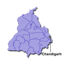
| Capital | Chandigarh |
| Districts (or Administrative Regions) | 22 |
| Government Website | punjab.gov.in |
| Demography of Punjab | |
| Largest Cities | Ludhiana, Amritsar, Jalandhar, Patiala and Bathinda |
| Population as per 2011 Census | 27,743,338 [Decadal Growth = 13.9% (from 2001 - 2011)] |
| Population Density | 550 persons / km2 |
| Official Languages | Punjabi |
| Other Languages | |
| Sex Ratio as per 2011 Census | 893 ♂ / 1000 ♀ |
| Literacy Rate as per 2011 Census | 75.8% Male = 80.4% and Female = 70.7% |
| Geography of Punjab | |
| Total Area | 50,362 km2 |
| Neighbouring States | Punjab touches the borders of Rajasthan, Jammu & Kashmir, Himachal Pradesh, Haryana (total 4 states/UTs). |
| Neighbouring Countries | Border of Punjab also touches the international border of Pakistan (total 1 countries). |
| International Border Length | 425 km |
| Coastal Border Length | Punjab is not a coastal state/UT. |
| State Symbols of Punjab | |
| State Animal | Blackbuck (Antilope cervicapra) |
| State Bird | Northern goshawk (Accipiter gentilis) |
| State Tree | Indian rosewood (Dalbergia sissoo) |
| State Flower | Gladiolus (Gladiolus grandiflorus) |
| Codes for Punjab | |
| ISO-3166-2-IN Code | IN-PB |
| Vehicle Code | PB |