- Home
- Knowledge Base
- India
- States and Union Territories
- Madhya Pradesh
Madhya Pradesh
| Official Name | Madhya Pradesh |
|---|---|
| Administration of Madhya Pradesh | |
| Status | State |
| Statehood / Establishment Date | 1 November 1956 |
| Zone | Central |
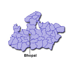
| Capital | Bhopal |
| Districts (or Administrative Regions) | 52 |
| Government Website | mp.gov.in |
| Demography of Madhya Pradesh | |
| Largest Cities | Indore, Bhopal, Jabalpur, Gwalior and Ujjain |
| Population as per 2011 Census | 72,626,809 [Decadal Growth = 20.3% (from 2001 - 2011)] |
| Population Density | 236 persons / km2 |
| Official Languages | Hindi |
| Other Languages | |
| Sex Ratio as per 2011 Census | 930 ♂ / 1000 ♀ |
| Literacy Rate as per 2011 Census | 69.3% Male = 78.7% and Female = 59.2% |
| Geography of Madhya Pradesh | |
| Total Area | 308,252 km2 |
| Neighbouring States | Madhya Pradesh touches the borders of Gujarat, Rajasthan, Uttar Pradesh, Chhattisgarh, Maharashtra (total 5 states/UTs). |
| Neighbouring Countries | Madhya Pradesh does not share its border with any other country. |
| International Border Length | 0 km |
| Coastal Border Length | Madhya Pradesh is not a coastal state/UT. |
| State Symbols of Madhya Pradesh | |
| State Animal | Barasingha (Swamp deer) (Rucervus duvaucelii) |
| State Bird | Indian paradise flycatcher (Terpsiphone paradisi) |
| State Tree | Banyan (Ficus benghalensis) |
| State Flower | Lilium candidum (Lilium candidum) |
| Codes for Madhya Pradesh | |
| ISO-3166-2-IN Code | IN-MP |
| Vehicle Code | MP |