Delhi
| Official Name | Delhi |
|---|---|
| Administration of Delhi | |
| Status | Union Territory |
| Statehood / Establishment Date | |
| Zone | Northern |
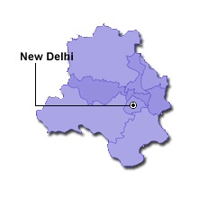
| Capital | New Delhi |
| Districts (or Administrative Regions) | 1 |
| Government Website | delhi.gov.in |
| Demography of Delhi | |
| Largest Cities | New Delhi |
| Population as per 2011 Census | 16,787,941 [Decadal Growth = 21.2% (from 2001 - 2011)] |
| Population Density | 11,297 persons / km2 |
| Official Languages | Hindi |
| Other Languages | Punjabi and Urdu |
| Sex Ratio as per 2011 Census | 866 ♂ / 1000 ♀ |
| Literacy Rate as per 2011 Census | 86.2% Male = 90.9% and Female = 80.8% |
| Geography of Delhi | |
| Total Area | 1,490 km2 |
| Neighbouring States | Delhi touches the borders of Haryana, Uttar Pradesh (total 2 states/UTs). |
| Neighbouring Countries | Delhi does not share its border with any other country. |
| International Border Length | 0 km |
| Coastal Border Length | Delhi is not a coastal state/UT. |
| State Symbols of Delhi | |
| State Animal | Nilgai (Boselaphus tragocamelus) |
| State Bird | House sparrow (Passer domesticus) |
| State Tree | Flamboyant (Delonix regia) |
| State Flower | Alfalfa (Medicago sativa) |
| Codes for Delhi | |
| ISO-3166-2-IN Code | IN-DL |
| Vehicle Code | DL |