Odisha
| Official Name | Odisha |
|---|---|
| Administration of Odisha | |
| Status | State |
| Statehood / Establishment Date | 26 January 1950 |
| Zone | Eastern |
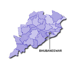
| Capital | Bhubaneswar |
| Districts (or Administrative Regions) | 30 |
| Government Website | odisha.gov.in |
| Demography of Odisha | |
| Largest Cities | Bhubaneswar, Cuttack, Brahmapur Town, Raurkela and Puri |
| Population as per 2011 Census | 41,974,218 [Decadal Growth = 14.0% (from 2001 - 2011)] |
| Population Density | 269 persons / km2 |
| Official Languages | Odia |
| Other Languages | |
| Sex Ratio as per 2011 Census | 978 ♂ / 1000 ♀ |
| Literacy Rate as per 2011 Census | 72.9% Male = 81.6% and Female = 64% |
| Geography of Odisha | |
| Total Area | 155,820 km2 |
| Neighbouring States | Odisha touches the borders of Chhattisgarh, Jharkhand, West Bengal, Andhra Pradesh (total 4 states/UTs). |
| Neighbouring Countries | Odisha does not share its border with any other country. |
| International Border Length | 0 km |
| Coastal Border Length | The total length of coast line of Odisha is 476 km |
| State Symbols of Odisha | |
| State Animal | Sambar (Rusa unicolor) |
| State Bird | Indian roller (Coracias benghalensis) |
| State Tree | Ashoka tree (Saraca asoca) |
| State Flower | Ashoka (Saraca asoca) |
| Codes for Odisha | |
| ISO-3166-2-IN Code | IN-OR |
| Vehicle Code | OD |