Sikkim
| Official Name | Sikkim |
|---|---|
| Administration of Sikkim | |
| Status | State |
| Statehood / Establishment Date | 16 May 1975 |
| Zone | North-Eastern |
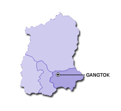
| Capital | Gangtok |
| Districts (or Administrative Regions) | 4 |
| Government Website | sikkim.gov.in |
| Demography of Sikkim | |
| Largest Cities | Gangtok |
| Population as per 2011 Census | 610,577 [Decadal Growth = 12.9% (from 2001 - 2011)] |
| Population Density | 86 persons / km2 |
| Official Languages | Nepali and English |
| Other Languages | Bhutia, Gurung, Lepcha, Limbu, Manggar, Mukhia, Newari, Rai, Sherpa and Tamang |
| Sex Ratio as per 2011 Census | 889 ♂ / 1000 ♀ |
| Literacy Rate as per 2011 Census | 81.4% Male = 86.6% and Female = 75.6% |
| Geography of Sikkim | |
| Total Area | 7,096 km2 |
| Neighbouring States | Sikkim touches the borders of West Bengal (total 1 states/UTs). |
| Neighbouring Countries | Border of Sikkim also touches the international border of China, Bhutan , Nepal (total 3 countries). |
| International Border Length | 350 km |
| Coastal Border Length | Sikkim is not a coastal state/UT. |
| State Symbols of Sikkim | |
| State Animal | Red panda (Ailurus fulgens) |
| State Bird | Blood pheasant (Ithaginis cruentus) |
| State Tree | Rhododendron (Rhododendron niveum) |
| State Flower | Noble orchid (Cymbidium goeringii) |
| Codes for Sikkim | |
| ISO-3166-2-IN Code | IN-SK |
| Vehicle Code | SK |