Bihar
| Official Name | Bihar |
|---|---|
| Administration of Bihar | |
| Status | State |
| Statehood / Establishment Date | 26 January 1950 |
| Zone | Eastern |
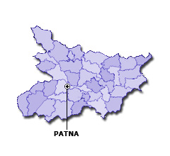
| Capital | Patna |
| Districts (or Administrative Regions) | 38 |
| Government Website | gov.bih.nic.in |
| Demography of Bihar | |
| Largest Cities | Patna, Gaya, Bhagalpur, Muzaffarpur and Biharsharif |
| Population as per 2011 Census | 104,099,452 [Decadal Growth = 25.4% (from 2001 - 2011)] |
| Population Density | 1,102 persons / km2 |
| Official Languages | Hindi |
| Other Languages | Urdu, Maithili, Angika, Bajjika and Bhojpuri |
| Sex Ratio as per 2011 Census | 916 ♂ / 1000 ♀ |
| Literacy Rate as per 2011 Census | 61.8% Male = 71.2% and Female = 51.5% |
| Geography of Bihar | |
| Total Area | 94,163 km2 |
| Neighbouring States | Bihar touches the borders of Uttar Pradesh, West Bengal, Jharkhand (total 3 states/UTs). |
| Neighbouring Countries | Border of Bihar also touches the international border of Nepal (total 1 countries). |
| International Border Length | 601 km |
| Coastal Border Length | Bihar is not a coastal state/UT. |
| State Symbols of Bihar | |
| State Animal | Indian bison / Gaur (Bos gaurus) |
| State Bird | House sparrow (Passer domesticus) |
| State Tree | Sacred fig (Ficus religiosa) |
| State Flower | Orchid Tree (Kachnar) (Bauhinia variegata) |
| Codes for Bihar | |
| ISO-3166-2-IN Code | IN-BR |
| Vehicle Code | BR |