Karnataka
| Official Name | Karnataka |
|---|---|
| Administration of Karnataka | |
| Status | State |
| Statehood / Establishment Date | 1 November 1956 |
| Zone | Southern |
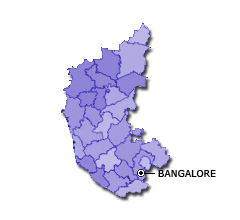
| Capital | Bangalore |
| Districts (or Administrative Regions) | 30 |
| Government Website | karnataka.gov.in |
| Demography of Karnataka | |
| Largest Cities | Bangalore, Hubli, Dharwad, Mysore, Gulbarga and Belgaum |
| Population as per 2011 Census | 61,095,297 [Decadal Growth = 15.6% (from 2001 - 2011)] |
| Population Density | 319 persons / km2 |
| Official Languages | Kannada |
| Other Languages | English |
| Sex Ratio as per 2011 Census | 968 ♂ / 1000 ♀ |
| Literacy Rate as per 2011 Census | 75.4% Male = 82.5% and Female = 68.1% |
| Geography of Karnataka | |
| Total Area | 191,791 km2 |
| Neighbouring States | Karnataka touches the borders of Goa, Maharashtra, Telangana, Andhra Pradesh, Tamil Nadu, Kerala (total 6 states/UTs). |
| Neighbouring Countries | Karnataka does not share its border with any other country. |
| International Border Length | 0 km |
| Coastal Border Length | The total length of coast line of Karnataka is 320 km |
| State Symbols of Karnataka | |
| State Animal | Indian elephant (Elephas maximus indicus) |
| State Bird | Indian roller (Coracias benghalensis) |
| State Tree | Sandalwood (Santalum album) |
| State Flower | Lotus (Nelumbo nucifera) |
| Codes for Karnataka | |
| ISO-3166-2-IN Code | IN-KA |
| Vehicle Code | KA |