Tamil Nadu
| Official Name | Tamil Nadu |
|---|---|
| Administration of Tamil Nadu | |
| Status | State |
| Statehood / Establishment Date | 26 January 1950 |
| Zone | Southern |
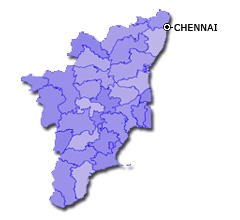
| Capital | Chennai |
| Districts (or Administrative Regions) | 37 |
| Government Website | tn.gov.in |
| Demography of Tamil Nadu | |
| Largest Cities | Chennai, Coimbatore, Madurai, Tiruchirappalli and Salem |
| Population as per 2011 Census | 72,147,030 [Decadal Growth = 15.6% (from 2001 - 2011)] |
| Population Density | 555 persons / km2 |
| Official Languages | Tamil |
| Other Languages | English |
| Sex Ratio as per 2011 Census | 995 ♂ / 1000 ♀ |
| Literacy Rate as per 2011 Census | 80.1% Male = 86.8% and Female = 73.4% |
| Geography of Tamil Nadu | |
| Total Area | 130,058 km2 |
| Neighbouring States | Tamil Nadu touches the borders of Kerala, Karnataka, Andhra Pradesh (total 3 states/UTs). |
| Neighbouring Countries | Tamil Nadu does not share its border with any other country. |
| International Border Length | 0 km |
| Coastal Border Length | The total length of coast line of Tamil Nadu is 907 km |
| State Symbols of Tamil Nadu | |
| State Animal | Nilgiri tahr (Nilgiritragus hylocrius) |
| State Bird | Emerald dove (Chalcophaps indica) |
| State Tree | Palmyra palm (Borassus) |
| State Flower | Glory lily (Gloriosa superba) |
| Codes for Tamil Nadu | |
| ISO-3166-2-IN Code | IN-TN |
| Vehicle Code | TN |