- Home
- Knowledge Base
- India
- States and Union Territories
- Andhra Pradesh
Andhra Pradesh
| Official Name | Andhra Pradesh |
|---|---|
| Administration of Andhra Pradesh | |
| Status | State |
| Statehood / Establishment Date | 1 October 1953 |
| Zone | Southern |
| Capital | Hyderabad (de jure), Amaravati (de facto) |
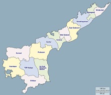
| Districts (or Administrative Regions) | 13 |
| Government Website | ap.gov.in |
| Demography of Andhra Pradesh | |
| Largest Cities | Visakhapatnam, Vijayawada and Guntur |
| Population as per 2011 Census | 49,506,799 [Decadal Growth = 11.0% (from 2001 - 2011)] |
| Population Density | 303 persons / km2 |
| Official Languages | Telugu |
| Other Languages | |
| Sex Ratio as per 2011 Census | 992 ♂ / 1000 ♀ |
| Literacy Rate as per 2011 Census | 67% Male = 74.9% and Female = 59.1% |
| Geography of Andhra Pradesh | |
| Total Area | 160,205 km2 |
| Neighbouring States | Andhra Pradesh touches the borders of Telangana, Chhattisgarh, Odisha, Tamil Nadu, Karnataka (total 5 states/UTs). |
| Neighbouring Countries | Andhra Pradesh does not share its border with any other country. |
| International Border Length | 0 km |
| Coastal Border Length | The total length of coast line of Andhra Pradesh is 974 km |
| State Symbols of Andhra Pradesh | |
| State Animal | Blackbuck (Antilope cervicapra) |
| State Bird | Rose-ringed parakeet (Psittacula krameri) |
| State Tree | Neem (Azadirachta indica) |
| State Flower | Jasmine (Jasminum officinale) |
| Codes for Andhra Pradesh | |
| ISO-3166-2-IN Code | IN-AP |
| Vehicle Code | AP |