Goa
| Official Name | Goa |
|---|---|
| Administration of Goa | |
| Status | State |
| Statehood / Establishment Date | 30 May 1987 |
| Zone | Western |
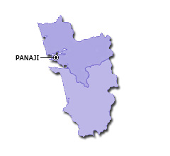
| Capital | Panaji |
| Districts (or Administrative Regions) | 2 |
| Government Website | goa.gov.in |
| Demography of Goa | |
| Largest Cities | Vasco da Gama and Panaji |
| Population as per 2011 Census | 1,458,545 [Decadal Growth = 8.2% (from 2001 - 2011)] |
| Population Density | 394 persons / km2 |
| Official Languages | Konkani |
| Other Languages | Marathi, Hindi, English and Kannada |
| Sex Ratio as per 2011 Census | 968 ♂ / 1000 ♀ |
| Literacy Rate as per 2011 Census | 88.7% Male = 92.6% and Female = 84.7% |
| Geography of Goa | |
| Total Area | 3,702 km2 |
| Neighbouring States | Goa touches the borders of Maharashtra, Karnataka (total 2 states/UTs). |
| Neighbouring Countries | Goa does not share its border with any other country. |
| International Border Length | 0 km |
| Coastal Border Length | The total length of coast line of Goa is 113 km |
| State Symbols of Goa | |
| State Animal | India bison / Gaur/ Gavoredo in Konkani (Bos gaurus) |
| State Bird | Flame-throated bulbul (Pycnonotus gularis) |
| State Tree | Coconut (Cocos nucifera) |
| State Flower | Red Jasmine (Plumeria rubra) |
| Codes for Goa | |
| ISO-3166-2-IN Code | IN-GA |
| Vehicle Code | GA |