Kerala
| Official Name | Kerala |
|---|---|
| Administration of Kerala | |
| Status | State |
| Statehood / Establishment Date | 1 November 1956 |
| Zone | Southern |
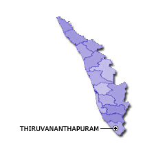
| Capital | Thiruvananthapuram |
| Districts (or Administrative Regions) | 14 |
| Government Website | kerala.gov.in |
| Demography of Kerala | |
| Largest Cities | Trivandrum, Kochi, Kozhikode, Kollam and Thrissur |
| Population as per 2011 Census | 33,406,061 [Decadal Growth = 4.9% (from 2001 - 2011)] |
| Population Density | 859 persons / km2 |
| Official Languages | Malayalam |
| Other Languages | English |
| Sex Ratio as per 2011 Census | 1084 ♂ / 1000 ♀ |
| Literacy Rate as per 2011 Census | 94% Male = 96.1% and Female = 92.1% |
| Geography of Kerala | |
| Total Area | 38,863 km2 |
| Neighbouring States | Kerala touches the borders of Tamil Nadu, Karnataka (total 2 states/UTs). |
| Neighbouring Countries | Kerala does not share its border with any other country. |
| International Border Length | 0 km |
| Coastal Border Length | The total length of coast line of Kerala is 570 km |
| State Symbols of Kerala | |
| State Animal | Indian elephant (Elephas maximus indicus) |
| State Bird | Great Indian hornbill (Buceros bicornis) |
| State Tree | Coconut (Cocos nucifera) |
| State Flower | Golden shower tree (Cassia fistula) |
| Codes for Kerala | |
| ISO-3166-2-IN Code | IN-KL |
| Vehicle Code | KL |