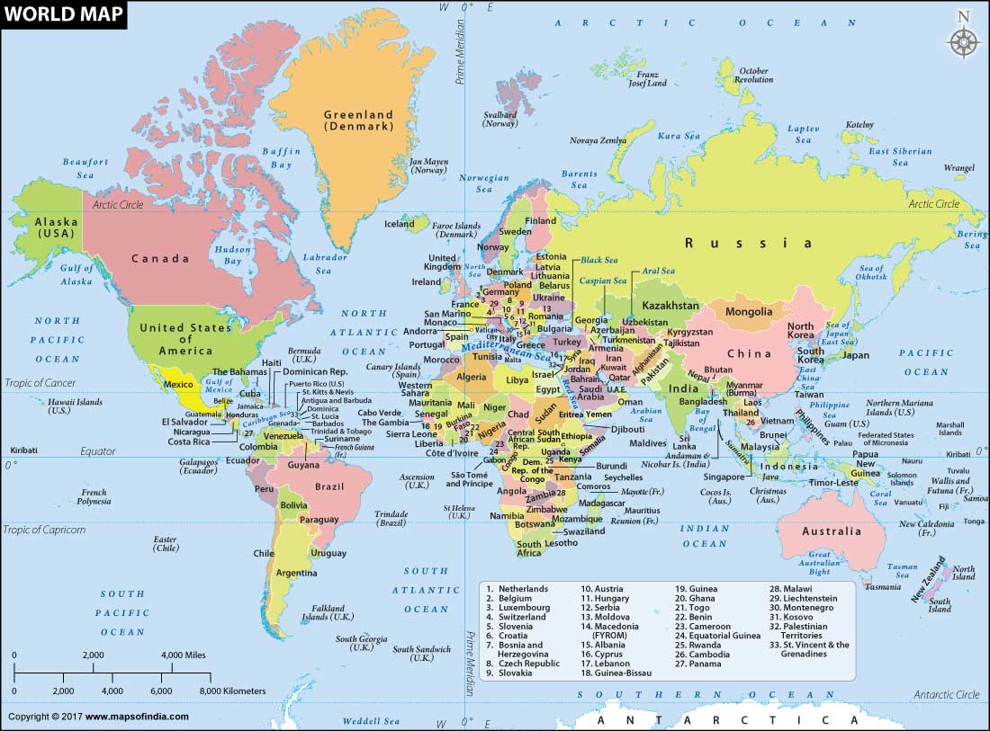
International borders are defined by geographical features or legal jurisdictions. These borders separate one country from another and crossing these borders requires permission from the country where you seek entry. Many of these international borders are famous (and thus have been named) because of reasons including wars and disputes. While countries in European Union allow free movement among member countries, international borders between countries like South Korea and North Korea are virtually sealed.
Today, we will have a look at some of the major international borders in India and the world.
Major International Boundaries in the World
| Border name | Between | Description |
| Hindenburg Line | Germany and Poland | The Germans marched to this line in 1917 during World War I. Hindenburg Line became irrelevant after the Treaty of Versailles in 1919. |
| Mason-Dixon Line | US states of Pennsylvania, Maryland, Delaware, and West Virginia | It was drawn up by Charles Mason and Jeremiah Dixon in the resolution of a border dispute involving Maryland, Pennsylvania, and Delaware in Colonial America. It is still a demarcating line between the US states of Pennsylvania, Maryland, Delaware, and West Virginia. |
| Maginot Line | Germany and France | This border has been named after the French Minister of War André Maginot. It is a line of concrete fortifications and weapon installations built by France in the 1930s to deter invasion by Germany. |
| Mannerheim Line | Russia and Finland | Mannerheim Line was a defensive fortification line on the Karelian Isthmus built by Finland against the Soviet Union during World War II. |
| Oder-Neisse Line | Poland and Germany | This border runs along the Oder and Lusatian Neisse rivers. It was recognized by unified Germany in 1990 as border with Poland. |
| Medicine Line | USA and Canada | Roughly 3,500 kilometres (2,175 mi) of the Canada–United States border was designated to follow the 49th parallel as international border. It was nicknamed the Medicine Line because of its seemingly magical ability to prevent U.S. soldiers from crossing it. |
| Siegfried Line | France and Germany | The Siegfried Line was a German defensive line built during the 1930s opposite the French Maginot Line. It stretched for more than 630 kilometers. |
| 17th Parallel | North Vietnam and South Vietnam | It used to define the boundary between North Vietnam and South Vietnam before the two regions were united in 1976. |
| 38th Parallel | South Korea and North Korea | The 38th parallel is used to demarcate the central part of the Demilitarized zone between North and South Korea. |
| 24th Parallel | India and Pakistan | It is the line which Pakistan claims for demarcation between India and Pakistan. This, however, is not recognized by India. |
| 31st Parallel | Iran and Iraq | The same parallel also demarcates the border between the US states of Louisiana and Mississippi. |
| 25th Parallel | Mauritania and Mali | Northernmost section of the Mali-Mauritania border is marked by the Equatorial parallel. |
| 20th Parallel | Libya and Sudan | 20th northern latitude is used as the border between Sudan and Libya. |
| 22nd Parallel | Egypt and Sudan | Major portion of the international border between Sudan and Egypt is marked by 22nd latitude. |
Major International Boundaries in India
| Border name | Between | Description |
| Durand Line | India and Afghanistan | Durand Line was drawn up in 1893 by Sir Mortimer Durand. India recognizes Durand Line as international border but Afghanistan does not. |
| McMahon Line | India and China | McMahon Line was drawn up by Sir Henry McMahon, demarcating the frontier of India and China. China did not recognize the McMahon line and crossed it in Indo-China war in 1962. China still disputes the legality of McMahon line but it is the de facto border between India and China. |
| Radcliffe Line | India and Pakistan | Radcliffe Line was was demarcated by Sir Cyril Radcliffe for the Partition of India. This line created West Pakistan, India and East Pakistan. After liberation, East Pakistan became Bangladesh. |
| 24th Parallel North | India and Pakistan | The 24th parallel north is a circle of latitude that is 24 degrees north of the Earth’s equatorial plane. It demarcates boundary between India and Pakistan in Rann of Kutch. India does not recognize this boundary. |
| Line of Control (LoC) | India and Pakistan | LoC refers to the military control line between the Indian and Pakistani controlled parts of Jammu and Kashmir. It is not legally recognized international boundary. |
Use the citation below to add this article to your bibliography
"Major International Boundary Lines in India and the World." Dashamlav.com. Web. 1 May 2025. <https://dashamlav.com/international-boundary-lines-india-world/>
Dashamlav.com, "Major International Boundary Lines in India and the World." Accessed 1 May 2025. https://dashamlav.com/international-boundary-lines-india-world/
"Major International Boundary Lines in India and the World." (n.d.). Dashamlav.com. Retrieved 1 May 2025 from https://dashamlav.com/international-boundary-lines-india-world/

