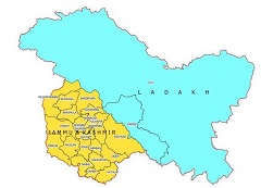
Ladakh
| Official Name | Ladakh |
|---|---|
| Administration of Ladakh | |
| Status | Union Territory |
| Statehood / Establishment Date | 31 October 2019 |
| Zone | Northern |
| Capital | Leh (summer) and Kargil (winter) |
| Districts (or Administrative Regions) | 2 |
| Government Website | ladakh.nic.in |
| Demography of Ladakh | |
| Largest Cities | Leh |
| Population as per 2011 Census | 290,492 [Decadal Growth = 23.6% (from 2001 - 2011)] |
| Population Density | 5 persons / km2 |
| Official Languages | Hindi and English |
| Other Languages | Ladakhi and Urdu |
| Sex Ratio as per 2011 Census | 0 ♂ / 1000 ♀ |
| Literacy Rate as per 2011 Census | 0% Male = 0% and Female = 0% |
| Geography of Ladakh | |
| Total Area | 59,146 km2 |
| Neighbouring States | Ladakh touches the borders of Jammu, Kashmir, Uttarakhand (total 3 states/UTs). |
| Neighbouring Countries | Border of Ladakh also touches the international border of China (total 1 countries). |
| International Border Length | 0 km |
| Coastal Border Length | Ladakh is not a coastal state/UT. |
| State Symbols of Ladakh | |
| State Animal | Not declared yet (Not declared yet) |
| State Bird | Not declared yet (Not declared yet) |
| State Tree | Not Designated (Not Designated) |
| State Flower | Not Designated (Not Designated) |
| Codes for Ladakh | |
| ISO-3166-2-IN Code | TBA |
| Vehicle Code | LA |