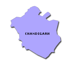
Chandigarh
| Official Name | Chandigarh |
|---|---|
| Administration of Chandigarh | |
| Status | Union Territory |
| Statehood / Establishment Date | |
| Zone | |
| Capital | Chandigarh |
| Districts (or Administrative Regions) | 1 |
| Government Website | chandigarh.gov.in |
| Demography of Chandigarh | |
| Largest Cities | Chandigarh |
| Population as per 2011 Census | 1,055,450 [Decadal Growth = 17.2% (from 2001 - 2011)] |
| Population Density | 9,252 persons / km2 |
| Official Languages | English |
| Other Languages | |
| Sex Ratio as per 2011 Census | 818 ♂ / 1000 ♀ |
| Literacy Rate as per 2011 Census | 86% Male = 90% and Female = 81.2% |
| Geography of Chandigarh | |
| Total Area | 114 km2 |
| Neighbouring States | Chandigarh touches the borders of (total 1 states/UTs). |
| Neighbouring Countries | Chandigarh does not share its border with any other country. |
| International Border Length | 0 km |
| Coastal Border Length | Chandigarh is not a coastal state/UT. |
| State Symbols of Chandigarh | |
| State Animal | Indian Gray Mongoose (Herpestes edwardsi) |
| State Bird | Indian grey hornbill (Ocyceros birostris) |
| State Tree | Mango Tree (Mangifera Indica) |
| State Flower | Palash (Butea monosperma) |
| Codes for Chandigarh | |
| ISO-3166-2-IN Code | IN-CH |
| Vehicle Code | CH |