- Home
- Knowledge Base
- India
- States and Union Territories
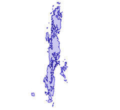
- Andaman and Nicobar Islands
Andaman and Nicobar Islands
| Official Name | Andaman and Nicobar Islands |
|---|---|
| Administration of Andaman and Nicobar Islands | |
| Status | Union Territory |
| Statehood / Establishment Date | |
| Zone | Bay of Bengal |
| Capital | Port Blair |
| Districts (or Administrative Regions) | 3 |
| Government Website | andaman.gov.in |
| Demography of Andaman and Nicobar Islands | |
| Largest Cities | Port Blair |
| Population as per 2011 Census | 380,581 [Decadal Growth = 6.9% (from 2001 - 2011)] |
| Population Density | 46 persons / km2 |
| Official Languages | English and Hindi |
| Other Languages | |
| Sex Ratio as per 2011 Census | 878 ♂ / 1000 ♀ |
| Literacy Rate as per 2011 Census | 86.6% Male = 90.3% and Female = 82.4% |
| Geography of Andaman and Nicobar Islands | |
| Total Area | 8,249 km2 |
| Neighbouring States | Andaman and Nicobar Islands touches the borders of (total 1 states/UTs). |
| Neighbouring Countries | Andaman and Nicobar Islands does not share its border with any other country. |
| International Border Length | 0 km |
| Coastal Border Length | The total length of coast line of Andaman and Nicobar Islands is 1962 km |
| State Symbols of Andaman and Nicobar Islands | |
| State Animal | Dugong (Dugong dugon) |
| State Bird | Andaman wood pigeon (Columba palumboides) |
| State Tree | Andaman redwood (Pterocarpus dalbergioides) |
| State Flower | Andaman Pyinma (Lagerstroemia hypoleuca) |
| Codes for Andaman and Nicobar Islands | |
| ISO-3166-2-IN Code | IN-AN |
| Vehicle Code | AN |